REVIEW · KAUAI
Private Kauai Airplane Tour
Book on Viator →Operated by Ali'i Kauai Air Tours & Charters · Bookable on Viator
A plane window turns Kauai into a 3D map. On this private charter flight in a high-wing aircraft, you get big-window aerial sightseeing plus pilot narration that helps you make sense of what you’re seeing over the Na Pali Coast and Waimea Canyon.
I especially like the route’s focus on vertical, hard-to-see-from-road views, from the Na Pali seacliffs (about 4,000 feet) to the scale of Waimea Canyon, often called the Grand Canyon of the Pacific. One drawback to consider: this is weather-dependent, and on rare occasions there can be operational hiccups that lead to cancellations—so give yourself a little scheduling wiggle room if you can.
In This Review
- Key Things That Make This Flight Work
- Entering the Cockpit: How This Private 1-Hour Flight Runs
- Na Pali Coastline and Waimea Canyon: The Views You Can’t Replicate by Car
- Wai’ale’ale Crater and Alakai Swamp: Kauai’s High Country From the Cockpit
- Hanale’i Bay to Hanale’i Valley Waterfalls: North Shore Views With Story
- Ke’e Beach, Lumahai Beach, Queen’s Bath: The Coastline Details That Stay Hard to Find
- Kilauea Lighthouse and Jurassic Falls (Manawaiopuna Waterfall)
- Price and Value: What $369 Buys for a Private Flight
- Weather, Cancellations, and How to Schedule With Confidence
- Who Should Book This Tour, and Who Might Skip It
- Should You Book the Private Kauai Airplane Tour?
- FAQ
- How long is the private Kauai airplane tour?
- Where do I meet for the tour?
- Is this tour private, and how many people can be on the flight?
- What is the child policy for this experience?
- Is there a dress code?
- What happens if the tour can’t fly due to weather?
Key Things That Make This Flight Work
- Private group size (max 4): Only your group rides, so the pilot can tailor the story to your pace.
- High-wing aircraft + large windows: Great for sightseeing angles over Waimea Canyon and down the coast.
- A real pilot-led narration: You’re not just looking; you’re learning as you fly.
- North Shore-to-Inland route: You’ll connect cliffs, crater country, swamp, bay, and waterfall areas in about an hour.
- Casual, simple setup: Casual dress is fine, and you’ll get a mobile ticket.
Entering the Cockpit: How This Private 1-Hour Flight Runs
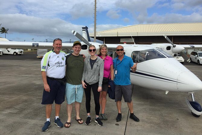
This tour is built around one straightforward promise: see Kauai from above without competing with a crowd. The experience is private, and the aircraft is limited to a maximum of 4 people per booking, with a minimum of 2. That small size matters. It makes it easier to hear the pilot’s commentary and get your attention on the views instead of juggling logistics.
Your group meets at 3745 Ahukini Rd, Lihue, HI 96766. You’ll use a mobile ticket, and the dress code is casual. The tour is described as lasting about 1 hour, so it’s a good fit when you want a major highlight without losing a full day to driving or long transfers.
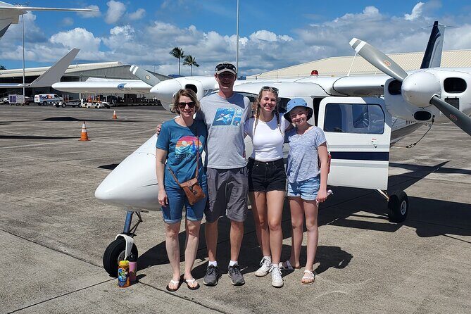
What’s also important: this is a high-wing plane. That design is often used for sightseeing because it gives you a stable view of the ground below—helpful when you’re trying to spot coastline geometry, canyon cuts, and waterfall lines as the pilot works the route.
Who will like this most? People who want the island’s big visuals fast—plus anyone who prefers a calm, focused experience over a packed group tour. If you’re visiting for the first time and want your bearings right away, an aerial loop is a smart shortcut.
Other private guided tours we've reviewed in Kauai

Na Pali Coastline and Waimea Canyon: The Views You Can’t Replicate by Car
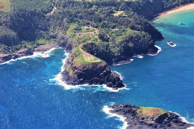
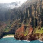
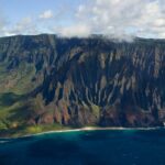
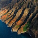
The flight’s first “wow” zone is the Na Pali Coastline, including about 4,000-foot seacliffs. From the road, you can see bits and viewpoints, but you can’t get the full picture of cliff bands, rugged ridgelines, and how everything stacks in depth. From the air, the Na Pali doesn’t feel like a single coastline—it feels like a whole system of cliffs and folds.
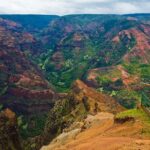
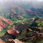
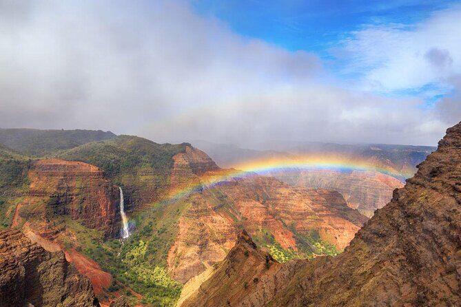
Next comes Waimea Canyon, often called the Grand Canyon of the Pacific. What you’re looking for up here is scale and structure: the canyon’s wide, carved walls, the way color bands and erosion patterns stretch across the view, and the clear separation between canyon walls and the areas beyond. The high-wing window setup is a real advantage here, because the pilot’s path helps you look across the canyon rather than only straight down.
A key detail: the pilot narrates what you’re seeing. That turns the canyon from a pretty view into something you can actually interpret. Instead of just thinking green and brown, you start recognizing the “why” behind the look—how the terrain is shaped, how the coastline and canyon relate, and why certain spots feel so dramatic from above.
Wai’ale’ale Crater and Alakai Swamp: Kauai’s High Country From the Cockpit
After the big canyon energy, the tour moves into interior terrain that feels different from the coast. Two stops stand out here: Wai’ale’ale Crater and Alakai Swamp.
Wai’ale’ale Crater is one of those places you hear about but can’t really “get” from ground level. From the air, you can see how crater country changes the way landforms sit next to one another. It’s the kind of view that makes you understand the island’s vertical character—how a place can feel close yet still be tucked into its own distinct geography.
Then there’s Alakai Swamp, described as the highest swamp in North America. That line alone gives you a clue that this is not just “some wet area.” In flight, the swamp area tends to look like a soft, mottled patchwork compared with sharper canyon walls or crisp coastline edges. You’re likely to notice how the terrain texture shifts as you move from dramatic cuts to higher, wetter country.
This section is one of the tour’s best values because it adds variety in a short time. The island isn’t only beaches and cliffs—it has interior features that shape weather, vegetation, and the overall look. From the air, those differences pop quickly.
Hanale’i Bay to Hanale’i Valley Waterfalls: North Shore Views With Story
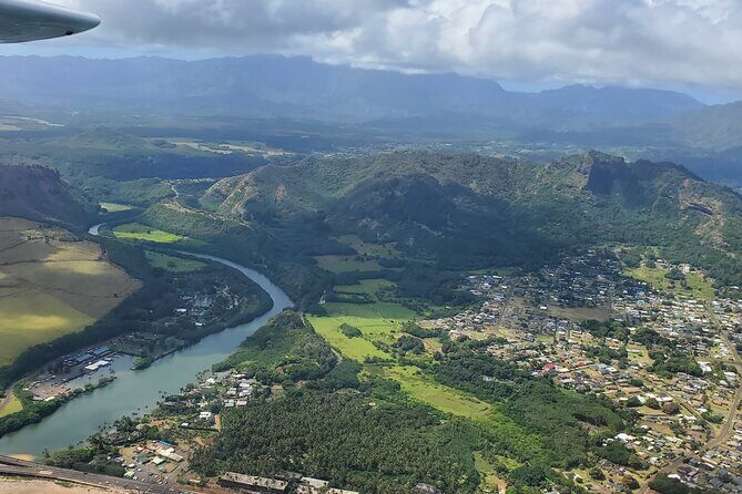
Once the flight turns toward the North Shore, it gets personal in a different way. You’ll pass over Hanale’i Bay and then Hanale’i Valley, including areas with numerous waterfalls.
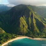
Hanale’i Bay is one of Kauai’s best-known stretches of water, and aerial views help you see how the bay sits against the surrounding land. If you want to understand how the coastline bends and where the valley opens toward the ocean, this is the section where the map in your mind starts clicking.
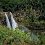
Then comes Hanale’i Valley, with its many waterfalls. From the ground, waterfalls can be spotty—blocked by trees, limited by angles, or hidden by fog in certain conditions. From the air, you get a broader sense of where water is running and how it threads down the valley. You’re not just seeing one cascade. You’re seeing patterns: thin lines, thicker flows, and multiple runs in one stretch of terrain.
This part of the route works particularly well if you like “connect-the-dots” travel. The pilot narration helps you connect the bay, the valley, and the broader island shape, so you leave with a stronger mental model than you would from a single lookout stop.
Ke’e Beach, Lumahai Beach, Queen’s Bath: The Coastline Details That Stay Hard to Find
The tour continues along the North Shore coast with Ke’e Beach, Lumahai Beach, and Queens Bath.
Here’s why those names matter: these are the kinds of places where the island’s coastline character—open water, protected pockets, reef edges—plays a huge role in what you can see and how it looks in any given moment. From the air, you can spot the differences in coastline shape and the way surf areas sit against rock.
Ke’e Beach gives you a strong sense of how the coast turns and how ocean meets land. Lumahai Beach is similarly useful for understanding the stretch of shoreline and where the bigger viewpoints and access areas tend to be. And Queens Bath is a spot people often look for because it sounds specific—and from above, the coastline’s layout helps you see why it’s a named feature rather than just a random section of rocks.
One practical tip: bring your attention to the coast lines you can’t reach easily by car. Aerial viewing is where the tour earns its keep. Even with a rental car and good viewpoints, there’s just too much coastline for one day to cover fully.
Other airplane and scenic flights we've reviewed in Kauai
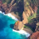

Kilauea Lighthouse and Jurassic Falls (Manawaiopuna Waterfall)
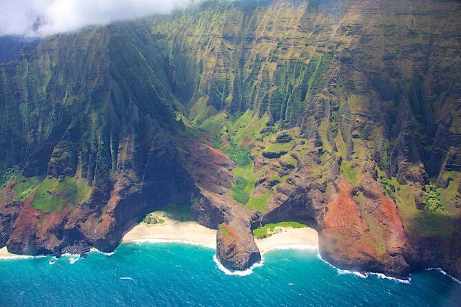
Near the end of the route, you’ll see Kilauea Lighthouse and Jurassic Falls (Manawaiopuna Waterfall).
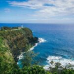
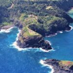
Kilauea Lighthouse is a recognizable landmark, and the value of seeing it from the air is how the surrounding coast frames it. The lighthouse isn’t just a dot—it’s part of a longer shoreline picture.
Then comes Jurassic Falls, also known as Manawaiopuna Waterfall. When waterfalls are viewed from the ground, you often get one angle. From the air, you get the broader context: where the water sits on the terrain, how the falls connect to the surrounding cliffs and forested areas, and how the island channels water as it drops.
This is a great end-cap for the flight because it ties the story together. You’ve seen canyon cuts, interior high country, valley water, and coastline texture. Ending with a named waterfall gives you a clear final highlight to remember.
Price and Value: What $369 Buys for a Private Flight
At $369 for the experience, the price isn’t “cheap.” But it can be fair—depending on how you’re traveling.
Because the tour is capped at 4 people, your per-person cost improves fast as group size increases. If you’re a pair, it’s still pricey, but you’re paying for privacy, a pilot-led narrative, and the ability to see a broad chunk of Kauai without spending the day on the road. If you can fill two spots and split the cost with a friend or family group, the value gets much easier to swallow.
The other value factor is time. The flight is about 1 hour, and in that window you cover major regions: Na Pali seacliffs, Waimea Canyon, crater and swamp areas, Hanale’i Bay and valley waterfalls, plus North Shore beaches and named points. If your schedule is tight and you want the island’s “big hits,” a short private flight can be a better trade than driving for hours to reach a handful of viewpoints.
One more point: people sometimes wonder if a helicopter is the only way to see places like Na Pali. This fixed-wing private tour focuses on wide, panoramic views from large windows, and the pilot narration helps you understand the terrain while you’re looking. It’s a different feel than a helicopter ride, but it can still scratch the “seeing Kauai from the sky” itch without turning your budget into a bonfire.
Weather, Cancellations, and How to Schedule With Confidence
This experience requires good weather, and if it’s canceled due to poor conditions, you’ll be offered a different date or a full refund. Also, while the tour is private and well-run, the data you were given includes an example of cancellations happening twice for reasons like fuel availability and mechanical issues. That’s not the expected norm—but it is a reason to plan wisely.
If you can, build in a little buffer on your Kauai schedule. Treat this as your “weather-permitting big highlight,” not the one single appointment you can’t move.
Who Should Book This Tour, and Who Might Skip It
Book this private flight if you want:
- High-impact sightseeing in about an hour
- Pilot narration that turns views into something you understand
- A small, private experience capped at 4 people
- The chance to see Na Pali Coastline and Waimea Canyon from the air, plus interior features and named North Shore spots
Skip it if:
- Your plans are rigid with no flexibility for weather
- You expect zero chance of last-minute change (even the best operators can face operational realities)
Should You Book the Private Kauai Airplane Tour?
If Kauai is a short stop for you, or you want one “wow” activity that gives you a real overhead map of the island, this is a strong pick. The small group size, the high-wing window setup, and the pilot-led storytelling are the core reasons it feels worth the money.
Just book with a bit of scheduling slack, and you’ll set yourself up for the best odds of clear views over the Na Pali and Waimea—plus those waterfall-and-lighthouse finish moments.
FAQ
How long is the private Kauai airplane tour?
The tour runs for about 1 hour.
Where do I meet for the tour?
The meeting point is 3745 Ahukini Rd, Lihue, HI 96766, USA.
Is this tour private, and how many people can be on the flight?
Yes. It is a private tour/activity, and only your group participates. The maximum is 4 people per booking, with a minimum of 2 people per booking.
What is the child policy for this experience?
A child rate applies only when sharing with 2 paying adults. Children must be accompanied by an adult.
Is there a dress code?
Dress code is casual.
What happens if the tour can’t fly due to weather?
The experience requires good weather. If it’s canceled due to poor weather, you’ll be offered a different date or a full refund.